


How do I use this KS1 Where I Live geography lessons in my classroom or home environment?
To use the KS1 Where I Live geography lessons in your classroom or home environment, start by introducing basic mapping skills using the "Where I Live Booklet" to help children identify continents, countries, and their local area. Engage students in hands-on activities like creating playground maps and using compasses to learn about position and direction. Take children on local walks to observe and record features of their neighbourhood, distinguishing between human-made and natural elements. Utilize resources like aerial photographs, local maps, and globes to enhance understanding. Incorporate personal experiences by having children map their journey to school or create autobiographical maps. For homeschooling, adapt activities to explore your immediate surroundings and use online tools like Google Maps or Google Earth to broaden geographical perspectives. Remember to make lessons interactive and inquiry-based, allowing children to investigate and solve geographical problems rather than passively receiving information.
What are some creative ways to engage KS1 students in local area geography lessons?

There are several creative ways to engage KS1 students in local area geography lessons:
1. Create a classroom map: Post a large map of the local area and have students mark places they've visited or places that are important to them. This personalizes the learning experience and makes geography more relatable.
2. Go on a local area walk: Take students on a short walk around the school neighbourhood. Have them observe and record features like buildings, parks, or landmarks. This hands-on experience helps develop their observational skills and understanding of their immediate environment.
3. Make a playground map: Have students create a simple map of their school playground. This activity helps them understand basic mapping concepts and spatial relationships.
4. Use technology: Utilize tools like Google Earth or virtual tours to explore the local area from different perspectives. This can be especially engaging for young learners.
5. Create a 3D model: Using materials like clay or recycled items, have students build a model of a local landmark or their neighbourhood. This tactile activity reinforces their understanding of geographical features.
6. Play direction games: Use simple compass directions to guide students around the classroom or playground. This helps them understand basic navigation skills and directional language.
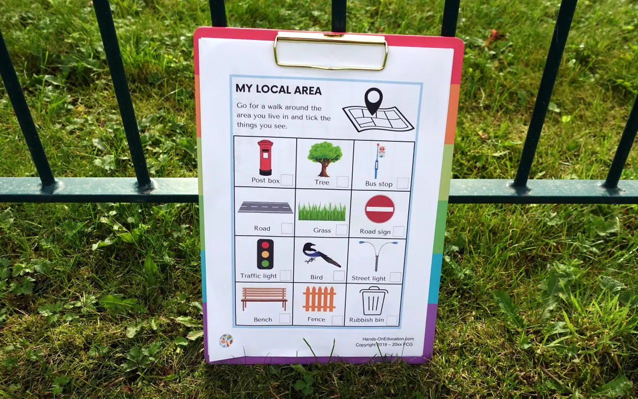
7. Local area scavenger hunt: Create a list of local features for students to find and tick off. This can be done during a field trip or as a homework activity with parents.
8. Draw picture maps: Have students draw maps of their journey from home to school, including key landmarks. This helps them visualize their daily geography and understand how to represent locations on paper.
These activities make geography lessons interactive, fun, and relevant to young learners, helping them engage more deeply with their local environment.
How can I incorporate fieldwork into my KS1 geography lessons?
Incorporating fieldwork into KS1 geography lessons is an excellent way to engage young students and bring geography concepts to life. Here are some ways to incorporate fieldwork effectively:
1. Explore the School Grounds
Start with the immediate environment that students are familiar with:
- Create a simple map of the playground and have students identify key features
- Use a compass to teach basic directions around the school
- Conduct a scavenger hunt to find human and physical features on the school grounds
2. Local Area Walks
Take short walks around the neighbourhood near the school:
- Use a checklist for students to identify and tally different types of buildings, natural features, or transportation methods they see
- Take photos of interesting geographical features to discuss back in the classroom
- Create simple sketch maps of the route taken
3. Weather Observations
Engage students in ongoing weather monitoring:
- Set up a simple weather station in the school grounds
- Have students record daily temperature, rainfall, or wind direction
- Create charts or graphs of weather patterns over time
4. Seasonal Changes Study
Observe how the local environment changes throughout the year:
- Visit the same location (e.g., a nearby park) in different seasons
- Document changes in plants, trees, and animal activity
- Create artwork or take photographs to compare seasonal differences
5. Traffic Survey
Conduct a simple traffic survey on a nearby safe road:
- Count different types of vehicles passing by
- Create a tally chart or pictograph of the results
- Discuss how traffic affects the local area
6. Mini Field Trips
Organize short trips to nearby locations of geographical interest:
- Visit a local park, river, or hill
- Explore different types of shops or services in the area
- Compare and contrast different neighbourhoods
Remember to always conduct proper risk assessments before any fieldwork activities and ensure appropriate supervision. These hands-on experiences will help develop students' observational skills, spatial awareness, and understanding of their local environment, laying a strong foundation for future geographical learning.
What are some effective methods to teach mapping skills to young students?

Teaching mapping skills to young students can be both engaging and effective when using hands-on, interactive methods. Here are some effective approaches:
1. Start with the basics: Introduce fundamental concepts like cardinal directions, map symbols, and simple map reading. Use an anchor chart to visually display key map elements and vocabulary. This provides a solid foundation for more complex map skills.
2. Use storytelling and literature: Incorporate map-themed books like "There's a Map on My Lap!" or "Me on the Map" to spark interest in maps and geography. After reading, engage students in discussions about the maps featured in the stories.
3. Create classroom maps: Have students draw maps of familiar spaces like their classroom or playground. This helps them understand how 3D spaces are represented in 2D form and practices their spatial awareness skills.
4. Incorporate technology: Utilize tools like Google Earth or interactive online mapping games to make learning more engaging and relevant to students' digital experiences.
5. Organize scavenger hunts: Design simple treasure hunts using maps of the school or local area. This practical application of map reading skills makes learning fun and memorable.
6. Use hands-on materials: Provide students with globes, atlases, and various types of maps to explore. Allow them to physically interact with these tools to better understand different map features.
7. Integrate mapping into other subjects: Use maps in history lessons to show historical events, in math to teach scale and distance, or in literature to track a character's journey. This cross-curricular approach reinforces the importance and versatility of mapping skills.
8. Create 3D maps: Have students build three-dimensional maps using materials like clay or salt dough. This tactile activity helps them understand geographical features and how they're represented on flat maps.
9. Practice with direction games: Use simple compass directions to guide students around the classroom or playground. This helps them internalize directional concepts and how they relate to map reading.
10. Encourage real-world connections: Take students on field trips or nature walks where they can use simple maps to navigate. This practical application helps students see the relevance of map skills in their daily lives.
How can I use personal geographies to enhance KS1 geography lessons?

Using personal geographies can greatly enhance KS1 geography lessons by making the subject more relatable and engaging for young learners. Here are some effective ways to incorporate personal geographies into your lessons:
1. Create Autobiographical Maps
Have students create maps of their daily lives, including:
- Their journey from home to school
- Important places in their neighbourhood
- Locations of family members or friends
This activity helps children understand how their personal experiences relate to geographical concepts.
2. Use Family History
Encourage students to explore their family's geographical history:
- Create family trees with locations
- Discuss where grandparents or parents grew up
- Compare different places family members have lived
This approach connects geography to personal stories, making it more meaningful.
3. Favourite Places Project
Ask students to present their favourite places:
- Local parks or playgrounds
- Holiday destinations
- Grandparents' homes
This project allows children to share personal experiences while learning about different locations and features.
4. Personal Weather Diaries
Have students keep a weather diary for a week or month:
- Record daily temperature, rainfall, or wind
- Draw pictures of the sky conditions
- Note how weather affects their activities
This activity connects personal observations to broader weather patterns and climate concepts.
5. Cultural Geography Exploration
Encourage students to share aspects of their cultural background:
- Foods from different regions
- Traditional clothing or customs
- Languages spoken at home
This approach helps children understand the diversity of their classroom and community.
6. Local Area Fieldwork
Conduct fieldwork in the local area, focusing on personal connections:
- Visit places important to different students
- Compare how different children use the same spaces
- Discuss changes students have observed over time
This hands-on approach makes geography tangible and relevant to students' lives.
By incorporating these personal geography elements into your KS1 lessons, you can help students develop a stronger connection to geographical concepts and foster a deeper understanding of their place in the world.
What are some interactive activities for teaching about local features in your area?

There are several engaging and interactive activities you can use to teach students about local features in their area:
1. Create a neighbourhood scavenger hunt: Design a list of local landmarks, natural features, and community spaces for students to find and document. They can take photos or make sketches of each item they discover, encouraging them to observe their surroundings more closely.
2. Make a 3D map of the local area: Using materials like clay, cardboard, or recycled items, have students construct a three-dimensional representation of their neighbourhood or town. This hands-on activity helps them understand spatial relationships and geographical features.
3. Conduct a field trip journal activity: Take students on a walking tour of the local area, equipped with notebooks and pencils. Ask them to record observations about human and physical features, sketch interesting landmarks, and write down questions about what they see.
4. Create a digital story map: Using tools like Google My Maps or ArcGIS StoryMaps, guide students in creating an interactive digital map of their local area. They can add photos, descriptions, and even audio clips to highlight important features and share their knowledge.
5. Design a playground map: Have students create a detailed map of their school playground or a nearby park. This activity helps them practice basic mapping skills while focusing on a familiar and engaging space.
6. Organize a local area photography project: Assign students to capture images of specific local features, such as different types of buildings, natural elements, or community spaces. These photos can be compiled into a class exhibition or digital presentation.
7. Play "I Spy" with local features: Use large local area maps or aerial photographs and play a game where students have to locate specific features based on clues. This activity enhances their map-reading skills and familiarity with local geography.
8. Create a sensory map: Encourage students to use their senses to map their local area. They can record sounds, smells, textures, and visual elements to create a multi-sensory representation of their environment.
These interactive activities not only make learning about local geography more engaging but also help students develop a deeper connection to their community and environment.


